
Newquay’s coastline and environment is an important part of the area’s character; much loved and valued by local residents and visitors to the area. It plays an important part in quality of life; leisure pursuits and, of course, in setting Newquay’s position as a tourism destination.
However, the fragility of this particular part of the Cornish North Coast, stretching from The Gannel River to the west, to Watergate Bay in the east, is well documented, with over 20 incidents of landslides, rockfall and slope instability recorded on the British Geological Survey ‘GeoIndex’ database, with particular problems around Tolcarne Point, Tolcarne Beach, Whipsiderry and along the frontage of Watergate Road.
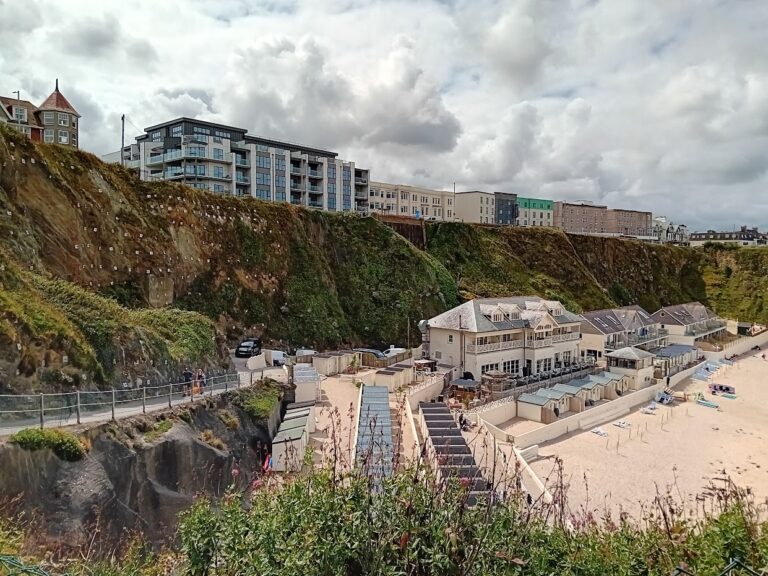
The level of fragility or robustness of Cornwall’s Coastline has been assessed through Cornwall’s Shoreline Management Plan (SMP), and its review in 2016, which notes a general deterioration in the cliffs in the entire parish over the last 15 years, particularly in response to pressure from developers for holiday accommodation and luxury properties overlooking the stunning Newquay waterfront.
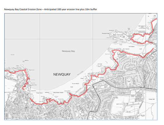
In response to this pressure, the Newquay Neighbourhood Development Plan, as implemented in 2019, has formerly designated the entirety of the Newquay Parish coastline (with the exception of the Harbour), as a Coastal Change Management Area (CCMA).
So what is a Coastal Change Management Area?
The CCMA is presented in accordance with Statutory Guidance, as presented in the National Planning Policy Framework (NPPF). The objective of the CCMA is to:
‘To manage the effects of physical change to the shoreline through erosion, coastal landslip, permanent inundation or coastal erosion both as they apply to new development proposals or to existing buildings, roads or other assets which become at risk from the effects of coastal erosion,’ and
To ensure that inappropriate development is not built near the coastal strip, ensuring that any development:
What does this mean in practice?
The success or failure of a planning application in a coastal area of Newquay will very much depend on proximity to the coastline, and projected rates of 100 year erosion.
The Newquay Neighbourhood Development Plan has designated the following zones:
The Exclusion Zone: defined as the anticipated 100-year erosion line identified on the Cornwall Council flood risk interactive mapping website plus a 10m buffer, and
The Coastal Erosion Vulnerability (CEV) Zone: defined as 30m from the landward edge of the Exclusion Zone.
What if my property of proposed redevelopment falls within an Exclusion Zone?
What if my property of proposed redevelopment falls within the Coastal Erosion Vulnerability (CEV) Zone?
All development proposals for new build, redevelopment, change of use, extension or enlargement within the CEV zone must be accompanied by a rigorous Coastal Erosion Vulnerability Assessment (CEVA).
Proposals will be supported where the CEVA confirms that the proposal will not cause damage to cliff faces or otherwise increase susceptibility to coastal change and where the proposal complies with all other relevant planning policies.
If you have questions about coastal erosion, coastal vulnerability assessments, landslides of landslips, then call Slope Stability Southwest, we would be happy to discuss your site and hopefully provide some advice to address your concerns.
Visit our website for more information.